The Distance Between Us will be presented at Wandering Arts Biennial 2016 over the next two weeks in Brussels, Belgium.
Mathieu Léger’s The Distance Between Us is a project that investigates the physicality and nature of exploration through walking to random preselected coordinates. This project is an experimental walking project using maps as material to alter itineraries and reflect on how we engage with space in both real and abstract ways. The true distance between us is not only spatial and temporal but also emotional.
Details about the walks and exhibition can be found below as well as on the Wandering Arts Biennial website, on their Facebook page, and on Nadine's website. The dates of the walks can be found below the second image.
Mathieu Léger’s artistic practice investigates everything; he is curious about notions of the body within systems, conceptually and physically, and how art is also a scientific process.

The Distance Between Us (WAB 2016 Edition)
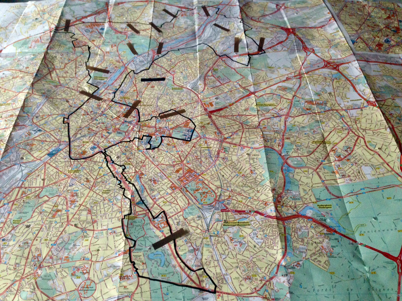
A path is a record of an event, or the duration of that event. In this project, a map becomes a tool to coordinate an event to create a path. Maps engage politics, culture, colonization, and discovery; they are powerful devices. In the project, The Distance Between Us, the artist uses a map of the city as a mechanism to determine locations that will culminate into a series of paths between places. These locations are only tied together through a hole made by piercing the folded map. Through this action, the artist conceptually links these places in space. The idea behind this project is to "stumble upon" a site. “I am interested in walking with people to discuss themes of boundary, distance, and physical limitations as it pertains to travelling (walking). Ultimately, I am curious about people's perception of distance and what they believe they are capable of doing physically. This is an enquiry into our engagement with human scales in an urban environment, where distances and space are mostly travelled using cars, trams, buses, metro, etc.” Conversations will happen around spatial awareness, location, travelling, distance, physicality, and what it means to be in a place. These themes all lie within the record of the path and the systems that come from circulating through this world. We build meaning through art and meaningful things come from exploring. How well do we really know our own cities? How large is your city when you transect it using your body rather than mechanical means?
" […] the subject of walking is, in some sense, about how we invest universal acts with particular meanings… Exploring the world is one of the best ways of exploring the mind, and walking travels both terrains." Rebecca Solnit, Wanderlust: A History of Walking

Coordinates as colours
The colours represent the coordinates of Brussels, Belgium, which are converted into RGB values. Using this method, every place has a set of distinct colours. This process was developed for the project Methodologies for Tourists.
Day 01 — 5 points — Distance: 12.5 km one way (20 km total)
Approximate time: 3 hours (5 hours return)
This walk leaves at 10:30 am, Friday, November 18, 2016 from Gallaitstraat 80 Rue Gallait • Brussel 1030 Bruxelles
Map: Path Day 01
Day 02 — 5 points — Distance: 12.5 km one way (15 km total)
Approximate time: 3 hours (4 hours return)
This walk leaves at 10:30 am, Saturday, November 19, 2016 from Gallaitstraat 80 Rue Gallait • Brussel 1030 Bruxelles
Map: Path Day 02
Day 03 — 5 points — Distance: 12.5 km one way (17km total)
Approximate time: 2 hours (4 hours return)
This walk leaves at 10:30 am, Tuesday, November 22, 2016 from Gallaitstraat 80 Rue Gallait • Brussel 1030 Bruxelles
Map: Path Day 03
If you wish to participate, please send an email through the contact button at the bottom of the column at the left of this page.
Images from the walks will be disseminated via Twitter • @MLegerArt • and through the artist's Facebook page •
Please note: Distances are calculated using Google Maps™. These distance can sometimes be very different from reality, this route system can be wrong and could have an impact on walk distances and times. These calculations are to be used as a starting point, as an estimate of the day’s expedition. Participants are free to come for the day or only part of the route. Participants are also responsible for their own snacks and water. Proper clothing and footwear must also be a consideration. The artist and Wandering Arts Biennial are not liable nor will they be held responsible for any participant in any way.
L'artiste désire remercier artsnb, la Fondation Sheila Hugh Mackay, le Conseil des arts du Canada, Nadine et Wandering Arts Biennial pour leurs appui.
The artist would like to acknowledge the support of artsnb, the Sheila Hugh Mackay Foundation, the Canada Council for the Arts, Nadine, and Wandering Arts Biennial.
